ABOUT DOWNTOWN
Board Meeting Schedule
21 Aug
18 Sep
16 Oct
20 Nov
18 Dec
WARM INSIDE...GREAT OUTDOORS

DDA District Businesses can use the township

Downtown Highland businesses have the option of utilizing the Digital Sign located within the Downtown Highland, DDA District at NO COST!
Businesses can choose one or two weeks per year to create an advertisement highlighting a special event or occasion. Examples include: Grand Openings, Special Anniversaries and Events. The Highland DDA determines what is acceptable to place on the sign.
Businesses cannot advertise merchandise (example: Bird Seed $2.00 per pound)
Computer file requirements: .jpg, .png, .gif or .tiff formats. All artwork must be ready to go. The HDDA is not responsible for designing advertisements. (Please remember that the digital sign scrolls, this does not guarantee exclusivity.)
HIGHLAND DDA - ESTABLISHED 2004
In 2004 the DDA/TIF (Downtown Development Area/Tax Increment Financing) agreement was put into place and Highland’s DDA was created. The DDA is a designated area that allows a “capture” of tax dollars to finance projects that encourage economic development. The “capture” of DDA tax dollars is the difference between the 2004 “base” value and today’s “taxable” value. Only the increase - or decrease is “captured” thus encouraging a motivated DDA board. This does not increase taxes. In Highland the DDA “captures” Oakland County and OCC tax dollars that would otherwise go into Oakland county and OCC budgets. The DDA also “captures” from Highland General, Fire, Police and Library tax dollars.
Some projects financed by the DDA include lamp posts, sidewalks, road paving, signage, business, building facade improvements and community events such as concerts and the December tree lighting.
There is not a township wide millage for the DDA. Millages are taxed over the entire township. The DDA capture only affects the parcels within the DDA. DDA boundaries are up & down Milford Road starting at Wardlow to the North and ending just before Rowe to the South. It also includes the Library to Save- A-Lot along M 59 and on Livingston from the railroad tracks to the Fire Hall.
The goal of a DDA is to encourage economic growth in a designated area resulting in increased value – hopefully affecting surrounding areas too.

MISSION
 Who we are & what we do: The Highland Downtown Development Authority (HDDA) is dedicated to the promotion of economic growth and historic preservation in Highland Station and surrounding business districts.
VISION
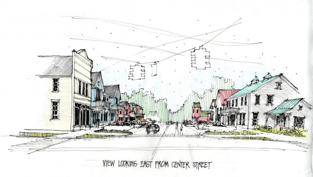
What we see for our future: Our vision for the Highland Station district is to return Highland Station to its place as the center of our community and a destination within the region. One Where attractive historical homes, vibrant small businesses, and healthy lifestyle amenities appeal to people of all ages.
OUR HISTORY

Highland Township was established by an act of Michigan's Territorial Legislature on March 17, 1835. It was so named because of its elevated position, containing some of the highest land in the then-settled part of the state. The northern part of the Township drains into the Shiawasee River watershed, leading to Saginaw Bay, while the southern portion drains into the Huron River via Pettibone Creek, and thence to Lake Erie.
Settlement of Highland began even before the Township's formal creation, with the first purchase of government land being made by Naham Curtis on September 6, 1832. Over the next eight years a steady stream of other settlers arrived, including members of the Adams, Armstrong, Beach, Dunham, Leonard, Lockwood, Stratton and Tenny families; many of whose descendants still reside in the area. By the time of the 1840 Census Highland had a population of over 560 residents.
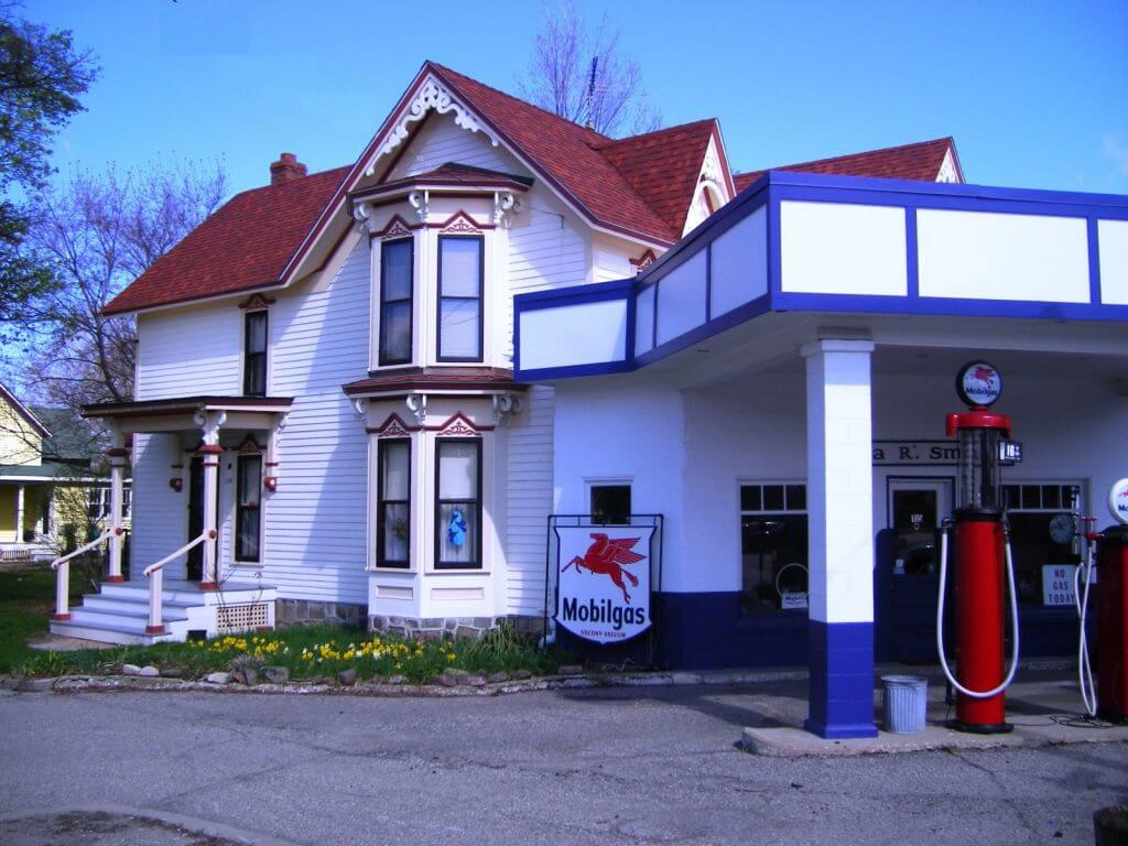
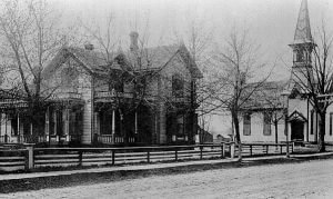
The original "Village of Highland" (later known as "Spring Mills") was located at what is now the intersection of M-59 and Harvey Lake Road, where the waters of Pettibone Creek provided power for both a grist mill and cider mill. With the completion of the Flint & Pere Marquette (now CSX) Railroad in the early 1870's, however, the focus of development shifted west to what is still known as "Highland Station," centered at the intersection of Milford and Livingston Roads. This historic area formerly included a depot, post office, grain elevator, pickle works, and wind-powered planing mill, in addition to the Victorian-era churches, homes and businesses which survive to this day. The railroad was likewise responsible for the establishment of the Village of Clyde; a once-busy post-office in the northern part of the Township.
Recreation began to replace agriculture in the early 20th century, as both residents and out-of-town "cottagers" began to appreciate the recreational value of Highland's numerous lakes, including Duck Lake and the western half of White Lake. The Township is also home to Dodge Brothers State Park No. 10, as well as part of the former Edsel Ford estate of "Haven Hill," which collectively constitute the Highland State Recreation Area.
For more information visit the Highland Township Historical Society visit http://www.highlandtownshiphistoricalsociety.com
There you will find a detailed Township history, 1840 Census transcript, historic photographs and links to other Highland-related information.
PLANS
A number of local reports have been prepared over the last 10 years relating to the HDDA area and the plans for the future.
2008 Highland Station Master Plan
1999 Highland Township Civic Center Design Criteria
REPORTS
A benefit of Highland being a Main Street Oakland County community is the wealth of experience we can access. In 2006, consultants with the National Main Street Center visited Highland three times and provided their observations and recommendations in reports.
May 2006 Tech Visit - Milford Rd. Design